Storm Khanun enters East Sea, heading for north-central Viet Nam
According to the Mid-Central Region Centre for Hydro-meteorological Forecasting, tropical storm Khanun had crossed the northern Philippines, and then entered the East Sea early yesterday morning.
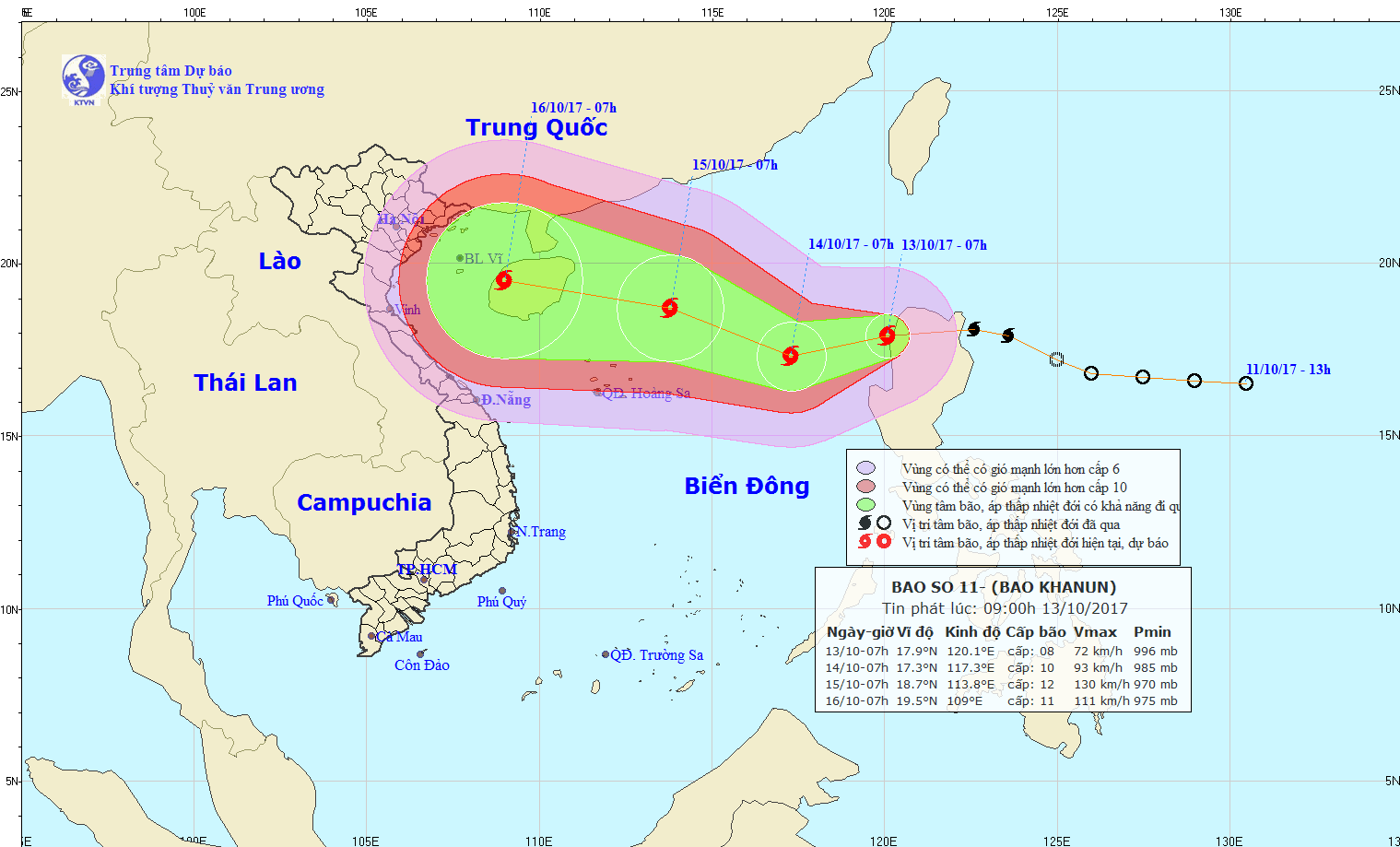 |
| The expected path of the storm |
At 1.00pm yesterday, the storm was positioned at latitude 17°4’N and longitude 119°2’E, about 740km east-northeast of the Hoang Sa archipelago. It is predicted to carry wind speeds of 60 - 75kph (level 8/12) near its centre.
Over the next 24 hours, the storm is expected to continue moving in a westerly or south-westerly direction at a speed of between 10kph and 15kph, and then it is forecast to be stronger.
At 1.00pm today, 14 October, Khanun’s position is predicted to be at latitude 17°5’N and longitude 116°5’E, about 450km east-northeast of the Hoang Sa archipelago. The strongest wind speeds near its centre are between 90 and 100kph (level 13).
Due to the effects of this storm, the eastern area of the East Sea is experiencing rough seas, thundery showers and strong winds at level 9/10. The Da Nang area and elsewhere along the central coast from Quang Binh to Quang Ngai provinces are expected to experience moderate rain and thunderstorms in the evening over the next few days. In addition, there will be north-easterly winds at level 4/5, sea waves from 0.75 to 1.75m high, and slightly rough seas.
Over the next 48 to 72 hours, the storm is forecast to move in a westerly or south-westerly direction at a speed of about 20km per hour.